Highlighted by a blaze of fall colors, Board Members of the Maine Chapter of the International Appalachian Trail (MIAT) traveled along the Mohawk Trail (Rt.2) to Williams College, Williamstown, Mass. to attend the 3-day Annual 35th Gathering of the Appalachian Long Distant Hikers Association (ALDHA).
The MIAT participants; Dick Anderson, Walter Anderson, Cliff Young, Bill Duffy, and Josh Bowe, arrived Friday noon at Greylock Hall to assemble our assigned information/display booth, strategically located next to the ALDHA registration table and with prominent visibility and ready accessibility for visitors. Attendance at the “Gathering” was designated at 500 souls.
In addition to our information booth, the ALDHA program included two 1 ½ hour slots for five MIAT power point presentations: (1) IAT History & Deasey Mt. Historic Fire Cab Designation (Dick); (2) Pioneers in Appalachian Geology (Walter); (3) IAT AGM in Ireland & Northern Ireland (Walter); (4) Hiking the IAT in Greenland (Bill); (5) Katahdin Woods & Waters National Monument (Walter). All were well attended. Attendance for presentations 4 & 5 were packed with standing room (50+) & well applauded. The mention of Roxanne Quimby was greeted with standing ovation and cheers!
A variety of interesting folks visited our booth over two days including, several of whom recently hiked the IAT in the British Isles on the West Highland Way, Great Glen Way, Cape Wrath and the Ulster Way. Ron Tipton, Director of the Appalachian Trail Conservancy (ATC) and Sandi Mara, Chair of the ATC Board of Directors and her husband Chris honored us with a lengthy visit and discussion. A famous long distant hiker, trail name “Billy Goat” stopped by and informed us that he was 2300 miles short of a total of 50,000 miles hiked!
This ALDHA 3 day event was, as usual, a great way to meet and network with a lot of avid long distant hikers and inform them of IAT news and hiking opportunities.
Celebrating a National Treasure – Katahdin Woods & Waters National Monument
Roxanne Quimby, Lucas St. Clair, and his twin sister Hannah Quimby hosted a grand celebration on the shores of Millinocket Lake at New England Outdoor Center’s Twin Pine Camps. The Natural Resources Council of Maine, The Wilderness Society, The Pew Charitable Trust, the National Parks Conservation Association, and the Conservation Lands Fund joined Roxanne, Lucas, and Hannah in thanking everyone who contributed to securing the designation of the Katahdin Woods & Waters National Monument by President Barack Obama.
Don Hudson, Phine Ewing, Walter Anderson, Elaine and Eric Hendrickson, Lindsay and Michael Downing, Mark and Susan Adams, Bart DeWolf, former board member Eric Horschak, Aaron Meguier, Terry and Craig Hill, and numerous other IAT members and friends were on hand to bask in the great excitement and appreciation sparked by the Quimby family’s generous gift — the largest gift to the people of the United States since the days of John D. Rockefeller and Paul Mellon.
The New England Outdoor Center’s Matt Polstein welcomed nearly 300 people to the formal gathering, looking out across Millinocket Lake to Katahdin, shortly after 5:00 pm. Sunday, August 28th. The highlight speeches were made by Secretary of the Interior, Sally Jewell and Liliane Willens. Secretary Jewell spoke about the significance of the gift to the nation, the importance of land such as this to the health and well-being of all Americans, and the special qualities of the land — the East Branch of the Penobscot, the hiking opportunities — especially the IAT, and the richness of the geologic heritage.
Secretary Sally Jewell addresses the gathering mentioning the significance of geology to the richness of the area and to the International Appalachian Trail for helping to promote it.
Liliane Willens, Roxanne’s aunt, regaled the crowd with stories about her family’s path from Russia, through Shanghai, to the United States beginning after the Russian Revolution and concluding at the end of World War II. Lily believes Roxanne developed qualities of perseverance, grit, and determination from her maternal grandmother, who had lead the family through much of that trek. When Lucas St. Clair addressed the crowd he too raised a great laugh of appreciation when he spoke about the power and dominance of women in his family, and how at a young age he learned not to second guess either his mother’s wisdom or her determination to get a job done. Lucas was clearly relieved that this particular job was done!
Roxanne Quimby’s aunt Liliane Willens speaks to the crowd about the qualities of perseverance and grit her niece learned from her maternal grandmother.
The hard-working staff of NEOC provided the wonderful setting for the gathering, along with delicious food and drink. Dave Mallett and his band took the party deep into the night with an endless serenade for the party-goers.
Dave Mallett tunes up to serenade the crowd after a wonderful buffet dinner prepared by the staff of the New England Outdoor Center.
The first 31 miles of the IAT is now on land considered by President Barack Obama to be a national treasure, and we agree!
Obama signs order to create national monument in Maine’s North Woods
The president uses his executive authority to create the national monument on land donated to the federal government by entrepreneur and conservationist Roxanne Quimby.
President Obama designated more than 87,500 acres of forestland in Maine’s fabled North Woods as a national monument Wednesday in a historic but unilateral decision following years of bitter debate.
With the stroke of a pen, Obama created the Katahdin Woods and Waters National Monument – the second national monument in Maine history after Acadia National Park’s precursor – on land east of Baxter State Park in an area facing severe economic uncertainty. The move is likely to delight conservation activists and infuriate local opponents fearful the designation is trading potential industrial-based opportunities in the Katahdin region for mostly seasonal tourism jobs.
The designation is a substantial yet partial victory for Roxanne Quimby, the wealthy co-founder of the Burt’s Bees product line whose nonprofit, Elliotsville Plantation Inc., donated the land to the federal government this month. Quimby has pushed for years for a full-fledged national park in the North Woods but sought a lesser monument designation because it did not require congressional approval.
Roxanne Quimby donated 87,500 acres in the Katahdin region and advocated for its designation as a national monument.
“The new national monument – which will be managed by the National Park Service – will protect approximately 87,500 acres, including the stunning East Branch of the Penobscot River and a portion of the Maine Woods that is rich in biodiversity and known for its outstanding opportunities to hike, canoe, hunt, fish, snowmobile, snowshoe and cross-country ski,” reads a fact sheet released by the White House. “In addition to protecting spectacular geology, significant biodiversity and recreational opportunities, the new monument will help support climate resiliency in the region. The protected area – together with the neighboring Baxter State Park to the west – will ensure that this large landscape remains intact, bolstering the forest’s resilience against the impacts of climate change.”
Obama’s decision is unlikely to end the robust and often tense debate that has divided the Katahdin region’s business community and even some families, however.
While organizations such as the Katahdin Area Chamber of Commerce hope it will lure more tourists and create jobs, opponents warned it could further destabilize a forest products industry struggling to rebound from the closure of the Millinocket and East Millinocket paper mills. Many others have mixed views, seeing significant jobs potential but not in the industry that was once the backbone of the region.
Gov. Paul LePage as well as U.S. Rep. Bruce Poliquin, R-District 2, strongly opposed Quimby’s plan, based in large part on feedback from the forest products industry, sportsmen and others. The other members of Maine’s congressional delegation have been divided on the issue.
Residents in several Katahdin area towns such as East Millinocket and Medway have cast non-binding votes opposing a monument. Yet polls suggest the majority of Maine voters, including a majority in the state’s northern congressional district, supported a hypothetical monument designation.
The Mount Katahdin Road Company
On April 9, 1856, the Maine legislature approved a charter for a company consisting of Shepard Boody and others, for the construction of a road from the Aroostook Road to the summit of Mt Katahdin.
The route was surveyed and mapped in 1858, and on November 10, 1859, Shepard Boody sold, for one hundred dollars, all of his interest in the company to William Laweson its new president and G. P. Sewall, its clerk
John Neff in his book, KATAHDIN an Historic Journey, describes why a Mount Katahdin Road Company would have been chartered. At the time, there was a national urge to tame the wilderness and “the Katahdin area was subject to the same romantic notions”. The Road Company planned to make money by collecting tolls. Mount Washington was under development “and by 1859 a cog railroad was transporting visitors to Mount Washington’s summit”. In 1847, Marcus Keep envisioned a Katahdin Mountain House at the Katahdin Lake outlet. There were proposals to build a hotel at Chimney Pond and a bridal path to the summit of Katahdin. These proposals continued until well after the turn of the century.
Shepard Boody had been hired in 1838, by the land owners of T6-R11 WELS, to design and construct the Telos Cut, which would allow the waters normally flowing 80 miles north from Telos Lake to the St. John River and on down to Canada, to be diverted south, from a dam on Chamberlain Lake, to the East Branch of the Penobscot River and then down to Bangor. The project was completed in 1841.
The Journal and Survey of the road chartered by the Maine legislature, to the summit of Mt Katahdin, reports that the survey crew left Patten, Maine, Nov 1st 1858. It was not said how they travelled to Patten, but since a railroad to Patten was not completed until the 1890’s, they probably came from Old Town.
The survey crew consisted of:
David Haynes Surveyor Marcus R. Keep Chainman Charley Lyon Chainman Thomas Haynes Axe man
They traveled to the summit of Katahdin to start the survey.
“Proceed by stage and wagon to No 3 Range 5, and then by wagon and on foot to No 3 Range 6 and dine at Stacey’s, [probably at present-day Stacyville] Afternoon proceed to No 3 Range 7, sleep at Morrils”. [Morrills must have referred to the proprietors at the Hunt Farm at that time, because]: “on Tuesday Nov. 2nd, at 6 o’clock proceed up the East Branch of the Penobscot about one mile, [which is about one half mile south the present Luksoos EPI camps] raft over the river, thence follow up the N side of the Wassataquoik eight miles, ford the stream and dine at Barnett’s, camp on the south side of the stream [Wassataquoik]. Afternoon proceed westerly and camp at the outlet of Katahdin Pond. Wednesday Nov. 3rd, leave camp, and proceed westerly and arrive at Chimney Pond in the basin at 3 o’clock and camp. Thursday Nov. 4th ascend to the summit and commence our survey of the road at the corner of a rock marked K. It being the highest part of the mountain.” [The author has never heard of anyone searching for the “K” or any mention of it. The USGS set survey placques on the summit in 1941 and made no reference to it.]
The survey crew then proceeded measuring down through The Table Land “to the brink of the precipice Angle No 4, [ the approximate location of the Saddle trail].
From here “to the NE inlet of Chimney Pond, this distance obtained by try angle as the face of the mountain is such that it was doubtful of obtaining correct measure with the chain”
Friday Nov 5th and Saturday 6th, the crew traversed approximately parallel to today’s Chimney Pond trail, crossing the present road about half way between Avalanche Field and Roaring Brook and then proceeded on to Sandy Brook and “to a Maple tree, marked Angle No 12, standing in Katahdin path”. This point is on the current trail to Katahdin Lake. They continued on to a beaver dam. “We arrived here at 6 o’clock, and there is every appearance of snow storm, we leave the line and go ahead to the camp, at the outlet of Katahdin Pond and remain for the night.”
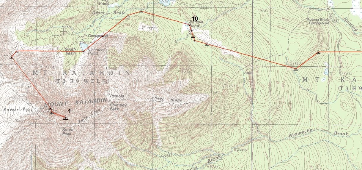
Sunday Nov 7th, “Remain in camp all day, it being very stormy”. This had to be Marcus Keep’s cabin and although Marcus Keep is recorded in the survey notes as a chainman, he was also a guide and had been guiding people to the summit of Katahdin since 1846.
Monday Nov 8th ,“we find a foot of snow on the ground; return to the beaver dam and continue the survey to a stump in Keep chopping marked angle No 18.” This is at the outlet to Katahdin Pond. From here on they do not record each day‘s work. At angle point No. 22 the crew is on the center line of No 3 Range 8, and 30 chains south of the Monument Line.
At angle point 33 they cross Wassataquoik stream and are 50 links south of the Monument Line. “Since passing angle No21 [to No 32] our courses have been Barnett logging road”.
The Monument Line was established in 1820, by the Act of Separation whereby Maine became a state separate from Massachusetts. At that time, the entire northern portion of what is now the State of Maine remained un-surveyed, and the location of the international boundary was unclear. It was estimated that there were 6 million acres to be surveyed. The Monument Line was established to aid in the equitable distribution, between Maine and Massachusetts, of land in this area that had not been conveyed prior to 1820. With few exceptions, all of the land north of the Monument Line was subdivided into square Townships with six mile borders. This section of the Monument Line was surveyed November 5th 1825 by Joseph Norris.
Surveyor David Haynes’ Field Notes record course, distance, and remarks for example:
Course Distance Remarks
S 57 E 42 00 To a Birch marked angle Angle No 7. Growth spruce & fir, surface even.
N 30 W 25 50 To a maple tree marked Angle No 14. land stony, growth small.
The courses, which are compass bearings, were taken to the degree, and the distances were recorded in chains and links. The remarks column was standard procedure for the surveyors of the day because they were explorers reporting back to the land owners on the quality of the soil and timber of the area they were traversing.
Chains have been used to measure horizontal distances since the early 17th century, if not before. In 1620 Edmund Gunther introduced a chain with 100 links that measured 66 feet, the link being 7.92 inches. Tapes of steel alloys with a very low coefficient of expansion were not introduced until around the turn of the 20th century. * Woods surveyors continued to use the 100 link chain for many years probably because they were more rugged and less likely to break than early steel tapes. Use of the Chain measure was efficient. Ten chains by one chain is an acre. 80 chains is a statute mile, so surveyors did not have to do any complicated mathematics. By foot measure, in contrast, a square acre is 208.69 feet on a side, which requires more complicated mathematics.
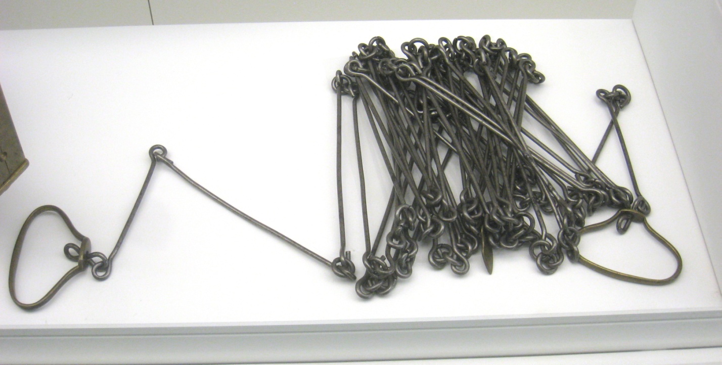
This is a 100 link 66 foot long chain. Each link is 7.92 inches
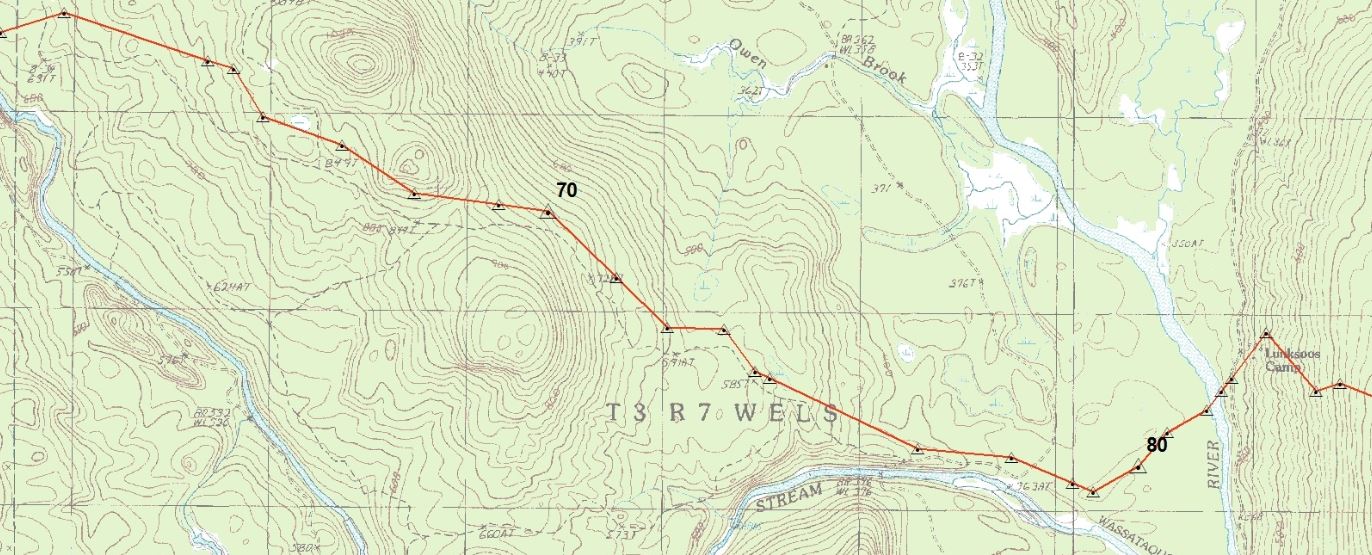
The Road Company’s Journal [kept by the surveyor, Haynes] indicates that the next 5 miles follow very closely the existing abandoned tote road along the northerly side of the Wassataquoik River. At angle No 57 the journal notes “the division line of No 3 Range 7,” and then the crew came “to the East Branch of the Penobscot,” which was 3 chains and 50 links wide. After the crew crossed the East Branch, they passed close to the current location of the Lunksoos Camps, which were not built at that time. They continued on through the woods “to the Aroostook Road at a point one chain northerly from the south east corner of Theodore Grafton garden lot in No3 Range 5”
Although there is no mention in the remarks about the hardships that the crew faced, there had to be many. In addition to equipment including chain, compass and axes, they had to carry some kind of shelter, blankets, cooking gear and food for many days. This, along with the cold and snow and at times traveling through uncharted forests made this a truly difficult task.
The Mount Katahdin Road was never built, although the last few miles from Stacyville to the Aroostook Road follow existing route 11, and the section from the Wassataquoik crossing to the East Branch follows an existing tote road that has been abandoned and is grown over.
The question arises, why was the road never built? The remoteness of the area certainly was a factor, and logging operations were making it difficult to maintain trails and changing the character of the country. The Civil War had just ended, and people were probably looking west for their investments. In contrast to the situation at Mt Washington, the railroad did not reach Patten, Maine until the 1890’s, more than 30 years after the route was surveyed. By that time the Millinocket area was developing and the access to Katahdin was moving to the south. Many feel that it is fortunate that the road was not built and eventually the access to Katahdin would be from the south.
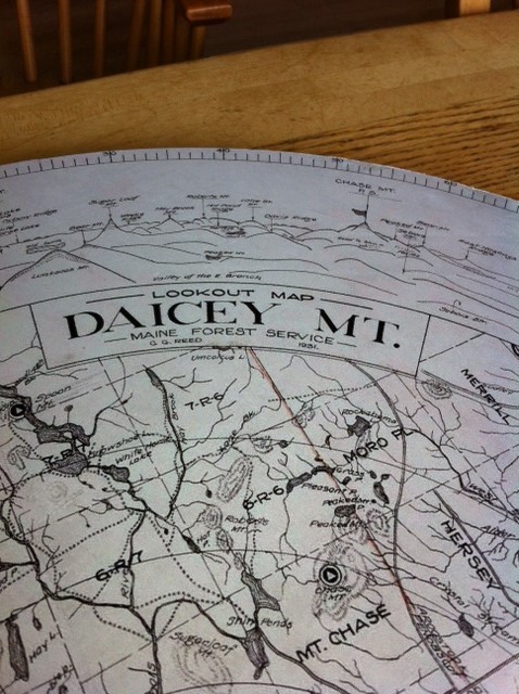
The surveyor, David Haynes, prepared a map of the proposed road from the field notes. The original field notes and map are in the James W. Sewall Company Vault, Old Town, Maine in File 5 No.5.
This account was written for Elliotsville Plantation Incorporated (EPI) and those at the National Park Service (NPS) working on the proposed Maine Woods National Monument. The area of the survey discussed makes reference to lands included in the Monument area, and is historically significant.
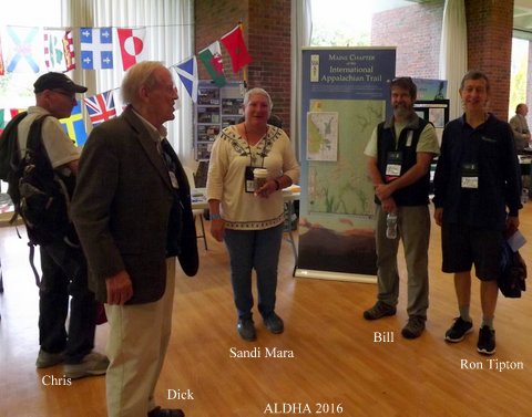
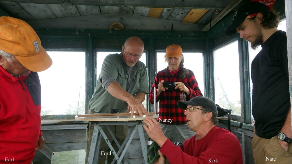
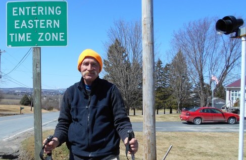
The author, Earl Raymond, is member of the International Appalachian Trail’s Maine Chapter. The trail’s starting point is just beyond Katahdin Lake and continues 30 miles through the EPI land to Matagamon, except for a short section near the East Gate of Baxter Park. During the last 13 years, Earl has helped design and maintain the trail, along with traveling over much of the proposed National Monument area. He is a graduate of the University of Massachusetts and the Yale School of Forestry, is a Professional Land Surveyor and Licensed Forester. He retired as the Chief Operating Officer of Sewall Company in Old Town, Maine, and stays active doing research on original surveys east of Katahdin and traveling.
*Smithsonian-National Museum of National History
Earl’s Alidade
June 2016 Trail Work Trip Report
Many thanks go to Mark and Susan Adams, Recreation Managers of Kathdin Woods & Waters Recreation Area (KWWRA) for the use of two comfortable cabins (Hunt and Deasey) at Lunksoos Camps for the Maine Chapter of the International Appalachian Trail (IAT-ME_ work crew from June 2 – 4, 2016 and for all of their much appreciated assistance during our work!
Mike Zimmermann (aka “Old Moose”) IAT-ME HikeOctober 10, 2015 & April 24 – May 8, 2016
Ever since hiking the Appalachian Trail (AT) in Maine in 2006, Mike Zimmerman (aka “Old Moose”) has been interested in hiking the International Appalachian Trail (IAT) in Maine and Canada. Since then, he has hiked the AT as far south as Sherburne, Vermont and two-thirds of the Long Trail in Vermont.
Old Moose actually started the IAT in Maine on October 10, 2015, when he took the Katahdin Lake Trail in Baxter State Park to Katahdin Lake Wilderness Camps, then continued on the South Katahdin Lake Trail to the park boundary at the Katahdin Lake East (KLE) access point, the IAT southern terminus. He hiked on the IAT for a total of 0.3 miles to the old Gardner Road before turning around.
May 2016 Trail Work Trip Report
Don Hudson arrived at Bowlin Camps before everyone else and rode his bike north on the IAT looking for blowdowns and clearing brush on the trail. Around noon, the rest of the work crew arrived: Dave Rand with his ATV, Julia Daly and two UMF students (Mike Paradis and Maria Noyola), Kirk and Cheryl St. Peter with an ATV, Lucy Leaf and Nancy Hathaway. We had the larger “No Aces” cabin for the women and the “Chapman 2” one room cabin for the guys. This had to be the first trail work trip ever where the women outnumbered the men!
IAT-ME Annual Meeting – May 6 – 8, 2016

The Maine Chapter of the International Appalachian Trail (IAT-ME) held its 2016 Annual Meeting at the Presque Isle Inn & Convention Center (PIICC) on May 6 – 8, 2016. Off site activities on Friday afternoon, on a gorgeous spring day to be out and on the mountain, included a tour of the SunEdison Wind Park, explanation of the interesting Mars Hill conglomerate geology, and a trip to the IAT Mars Hill lean-to.
International Appalachian Trail seeks to reroute 52 miles of path in Maine

The International Appalachian Trail continues to draw hikers to northern Maine, offering a tour through varied landscapes and a connection to Canada and beyond.
Trail enthusiasts celebrated some of the best of Aroostook County’s outdoors the weekend of May 7-8 at the International Appalachian Trail Maine Chapter’s annual conference in Presque Isle, sharing stories about local history and geology, visiting Mars Hill and Haystack mountains, and looking forward to the hiking season ahead.
One hiker known as Old Moose has already traveled through much of the Maine segment this spring, in a unique trip heading south from the Canadian border to Katahdin.
Created by volunteers in Maine, New Brunswick and Quebec 20 years ago, the International Appalachian Trail starts east of Baxter State Park, makes its way over more than 700 miles to Cap Gaspe, Quebec. The International Appalachian Trail’s trail network extends to Nova Scotia, Newfoundland, Labrador, Greenland and Iceland, and then across the Atlantic to the Appalachian’s sister mountains, the Caledonians, through Norway, Sweden, Denmark, Scotland, Northern Ireland, Ireland, England, France, Spain, Portugal and Morocco.More…