‘Monumental’ – A Journey through Katahdin Woods and Waters

On August 24th in 2016, 87,563-acres of land in the heart of Maine was designated the Katahdin Woods and Waters National Monument by President Barack Obama. Although met with controversy on all sides, the area had yet been explored on a large scale. In September 2017, a team of four Maine-born photographers set out on a three-part journey through Katahdin Woods and Waters to investigate. The goal? To refocus attention from the debate back onto why the monument was created in the first place: to protect and encourage public access to Maine’s outdoor resources. The short film Monumental showcases the area’s sweeping beauty and undeniable value to outdoor enthusiasts.

Katahdin Woods and Waters comprises miles of serene forest, winding rivers, and exquisite mountain peaks. The vast land is adjacent to Baxter State Park and was donated by the Quimby Family Foundation in addition to funds that would jumpstart its establishment. The location boasts premier hiking, canoeing, mountain biking, camping, hunting, fishing, kayaking, wildlife viewing, and sightseeing.

Save the Date! IAT Annual Meeting Shin Pond Village May 3 – 5

 
Mark your calendars! May 3 – 5 Maine IAT members and friends will be gathering at Shin Pond Village for the Maine IAT’s annual meeting!
 
There will be a very full agenda with many interesting presentations. We are working on finalizing the program and will be keeping you informed. A registration form with further details will be sent out very soon.
 
For now, be sure to put the dates on your calendar!Mai

Annual Appeal

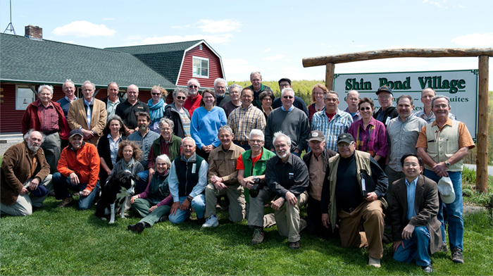
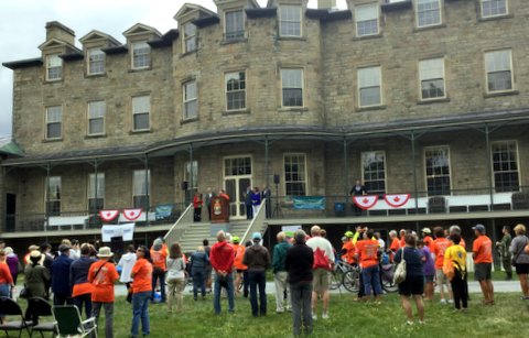
The Maine Chapter is wrapping up a very important year and we are looking ahead to making great strides in 2018. As a friend and supporter of the Maine Chapter, you have helped us complete, improve, and maintain one of the world’s great long distance trails. No other trail in the world has at its core a story of Earth history such as the IAT, and no trail community since that which created the Appalachian Trail has put the opportunity for rural economic development so clearly at the forefront of its mission. You have helped make that happen!
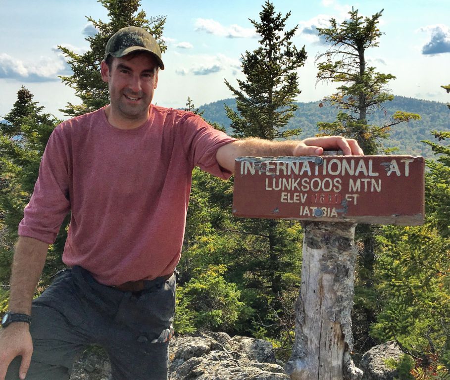
Since the morning in mid-October 1993 — at the Front Street Deli in Bath, Maine — that Dick Anderson first showed me a map of a trail that he had imagined, linking the three highest peaks in Maine, New Brunswick and Quebec, I have wondered whether or not I would walk it. After ducking the question — "Have you walked the IAT?" — countless times at gatherings and meetings of hikers and maintainers, I decided this past summer to walk the trail in North America. The Maine section had to be first, of course, and I completed the trail from Fort Fairfield to the new national monument east of Baxter State Park in the first week of October.
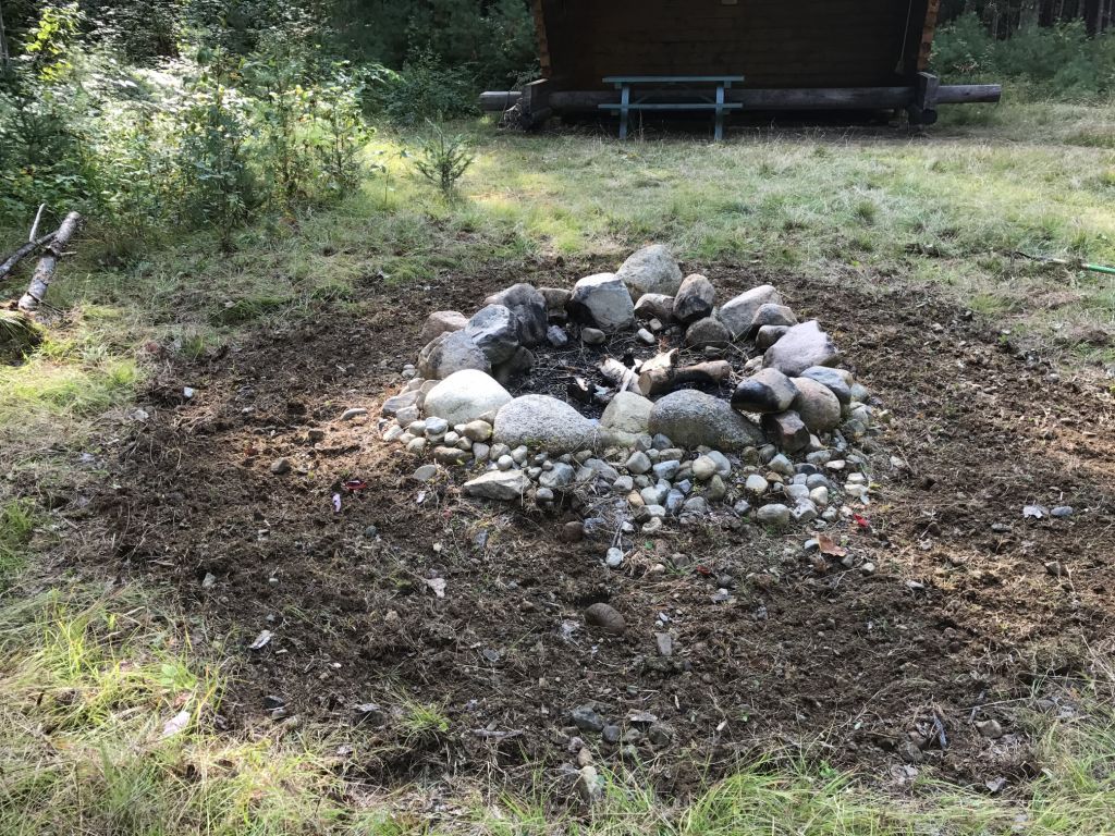
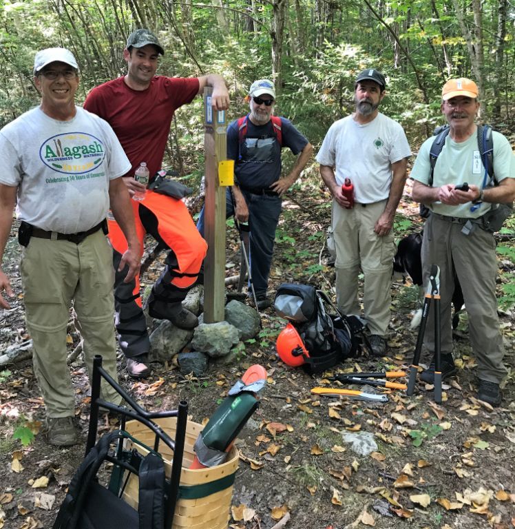
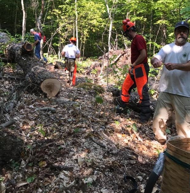
Now that first IAT miles are behind me, I can report to you with first hand experience that the dozens and dozens of volunteers who over the years have laid out, cut, and maintained our trail have done a remarkable job. When we presented our first map of the IAT on Earth Day 2000, over 80% of the trail in Maine was along the side of roads. It was not a bad walk, but one full of promise — promise that one day it might wind through the forests and along the streams and rivers of northeastern Maine. Twenty-three years later, nearly 80% of it is in the woods.
In addition to regular trail work and the efforts to relocate trail off of secondary roads, your support will help with the cost of updating the website and improving map and other resources for hikers on all sections of the trail in North America. We have started work on a map of the trail in North America and we envision a Cloud based companion guide to help people plan their long distance hikes or shorter walks along the trail from Katahdin to Crow Head in Newfoundland and the Nuussuaq Peninsula in Western Greenland. Companion guides were first written for the Appalachian Trail over thirty years ago, and we had a small printed version for the IAT in Maine, New Brunswick, and Quebec as early as 1998. These guides provide information about everything from public ground transportation to resupply, as well as opportunities for lodging, laundry, and other points of interest nearby the trail.
The IAT links people and places that ring the North Atlantic Ocean Basin, all of which share a common geologic heritage. Your gifts help us put it on the map!
With warm regards and thanks,
Sincerely,
Don Hudson,
President, IAT Maine and Co-chair, IAT International Council
To contribute to the annual appeal via paypal on website, go to www.internationalatmaine.org/support and click Donate.

Special Thanks to Eddie Woodin

The Maine IAT Patriot’s fans shared an afternoon of fun and football in Yarmouth watching the Patriots beat the Chargers 21 to 13.
Eddie Woodin, a long-time support of the International Appalachian Trail-Maine Chapter, generously presented IAT Maine Chapter President, Don Hudson with a $1,000 contribution.
His support is greatly appreciated by all the Board members.
Hopefully the IAT Patriots fans will be gathering for the superbowl!

Dick Anderson, Eddie Woodin, Don Hudson, Elizabeth Swain, Earl Raymond

Tour 150

Sentier NB Trail and the Fredericton Trails Coalition completed the much-anticipated ‘Tour 150’ on Saturday, August 26th, with the aim of bringing representatives of the diverse trail community in New Brunswick to one of Canada’s most trail friendly cities — Fredericton, New Brunswick — to celebrate the completion of Canada’s Great Trail. The Great Trail, envisioned over two decades ago, is the world’s longest continuous trail, tying together the east, west, and Arctic coasts of Canada in a 20,000 mile multi-use system of walkways, bikeways, ski-ways, and paddle-ways.
The International Appalachian Trail has a strong and abiding interest in the success of the trail movement in New Brunswick and Atlantic Canada, as the IAT is co-located with sections of the Great Trail in all five Atlantic Canada provinces. IAT Founder Dick Anderson and IAT Maine Board Members Walter Anderson and Don Hudson traveled to Fredericton to help celebrate ‘Tour 150’ and this great day for trails in Canada.

Dick Anderson, David Peterson, Don Hudson
IAT New Brunswick leader and Sentier NB Trail Executive Director Poul Jorgenson was one of the architects of Tour 150, and he was visibly excited to see trail users arrive on the back lawn of the residence of Lieutenant Governor Jocelyne Roy-Vinneau on the banks of the St. John River in Fredericton. They arrived on horseback, on bicycles and muscle-powered scooters, by canoe and kayak, as well as by walking and running. Trail enthusiasts from the four corners of the province were summoned — piped! — to the foot of the grand staircase by a ramrod bag piper in full uniform. Four pieces of a wonderful maple puzzle were delivered, coming together to make a wonderful representation of the province and its grand network of trails. Among the several speakers who warmed up the crowd, Past-President of the Fredericton Trails Coalition and Sentier NB Trail Dave Peterson made special mention in his remarks of the early work in 1994 and 1995 on the IAT in the province. Dave was a member of the original New Brunswick IAT Committee,, and was instrumental in shaping the early vision and route for the trail in the province.

Poul Jorgenson
The IAT Maine contingent was called out by several speakers, including representatives of local and provincial government, provincial agencies, Sentier NB Trail, and the Fredericton Trail Coalition. The Chair of the Board of Sentier NB Trail Jim Fournier sought Dick, Walter, and Don out in the crowd to make a special promise that his organization was committed to completing the IAT in the province, including the original route through the northwest corner of the province and a new southern connection with PEI and Nova Scotia.
Tour 150 was a great celebration of trails in New Brunswick, and the IAT was proud to be represented.

Fall 2017 Trail Work Trip Report

September 14, 2017
 
Kirk and Cheryl St. Peter met Bill Duffy and Josh Bowe at Sandbank Stream Campsite in Katahdin Woods & Waters National Monument (KWW), reviewed and initialed the appropriate Job Hazard Analysis forms (JHAs) as part of a tailgate safety meeting, and completed other required National Park Service (NPS) paperwork, then headed out to the Wassataquoik ford. While Kirk, Bill & Josh crossed the ford and investigated a possible alternate route to get to Lunksoos Lean-to, Cheryl mineralized the area around the Wassataquoik Lean-to fire pit and photographed the log book entries. She then drove the loop road to the Barnard Mountain trailhead parking and worked at the Katahdin Brook Lean-to (mineralized around the fire pit, lopped brush around the site and up the trail to the privy and photographed log book entries).
 
Maine IAT Board Member, Josh Bowe on Lunksoos Summit for the first time!
 
No one’s favorite task – mineralizing around the fire ring!
(L-R) Kirk St. Peter, Josh Bowe, Cliff Young, Bill Duffy, and Don Hudson at the junction of the old Keep Trail and the IAT
 
After returning to Sandbank, it was determined that the alternate route explored today was not feasible and that we would all cross the ford tomorrow and clear the trail at least up to the old Fire Warden’s Cabin, leaving a chainsaw at the cabin for work on Saturday. Don Hudson and Cliff Young arrived to help with the work tomorrow.
 
September 15, 2017
 
After reviewing the appropriate JHAs during a tailgate safety meeting and signing/initialing NPS forms, all six workers (Kirk, Cheryl, Bill, Don, Josh, and Cliff) drove to the Wassataquoik trailhead parking, crossed the ford and cleared trail north to the Fire Warden’s Cabin, with Kirk and Josh leapfrogging each other and using chainsaws to clear the multiple blowdowns. Everyone else used loppers and/or handsaws to clear brush; a few tags were added. We stopped at the cabin for lunch and left the smaller chainsaw there for work tomorrow. A few older trees that could be stepped over were left due to the time.
 
After returning to Sandbank, we determined that Bill and Cliff would investigate an alternate route to Lunksoos Lean-to tomorrow by crossing the Wassataquoik where the IAT diverges from the trail to Orin Falls and then heading straight up past the east side of a pond to old logging roads, flagging the route if it appeared useable. Kirk and Josh would go the other way, following the IAT, while clearing blowdowns from the Fire Warden’s Cabin north. Cheryl and Richard Heath, who arrived that evening, would wait for Tom and Naomi Lynch (arriving in the morning) and do some additional work on the trail with loppers at least to the Fire Warden’s Cabin.
 
September 16, 2017
 
Kirk and Josh followed the IAT to the Fire Warden’s Cabin, where they picked up the chainsaw and cleared approximately a dozen blowdowns from there all the way north to Lunksoos Lean-to. Between the summit of Lunksoos and the lean-to, they met Bill and Cliff going the other way (they had stopped at the lean-to and mineralized around the fire pit). Kirk and Josh continued, following the alternate loop route that Bill and Cliff had flagged with orange flagging back to the Wassataquoik (potential trail name “Dave’s Cutoff” recommended by Earl Raymond due to his and Dave’s exploration of this route and all of Dave’s hard work on the trails). Bill and Cliff continued south on the IAT back to the trailhead. Cheryl, Richard, Tom and Naomi moved some posts with tags at the beaver dam crossing, then brushed the trail towards the Fire Warden’s Cabin. Since Naomi did not feel well, she and Tom turned back at the lookout and Cheryl and Richard continued to the cabin. Cheryl waited for Richard there as he continued to Deasey’s summit with loppers.
 
Cliff clears while Kirk and Josh cut and Bill “supervises”.
 
Notes:
 
The IAT from Wass. ford to Deasey’s Summit is in excellent condition, with a developing treadway and it is mostly clear of brush, with sufficient tags for a novice to follow. There are a few old blowdowns that can be stepped over. There are also two very active ground hornet’s nests: one along the Wass. north of the beaver dam crossing and one near the lookout.We left a post with tags at the first “beaver dam” post, which should be taken up to another turn where we determined that a post would be useful. There is a rusted and broken eye bolt on the NW corner of the Deasey Fire Cab that needs to be replaced. The IAT from Deasey’s Summit to Lunksoos Lean-to is free of blowdowns, but could definitely use significant additional brush clearing. A small shovel could be left at Lunksoos Lean-to for ease of mineralizing the fire pit. There is an approximately 11½ mile route that could be developed as a useable loop trail from the Wassataquoik trailhead following the IAT to Lunksoos Lean-to, continuing on an old logging road and an older trail (that would require additional investigation and clearing) to cross the Wassataquoik at the junction of the IAT and the Orin Falls trail, back to the trailhead.This route also allows for trail workers to continue working over Deasey and Lunksoos to the lean-to with an easier downhill route back.

Stars over Katahdin

The International Appalachian Trail in Northern Maine begins in the new Katahdin Woods and Waters National Monument (KWWNM). That new Monument is in the largest area of pristine night sky east of the Mississippi River. From it we see stars that few in the eastern United States can view. The Monument’s sky quality meter reading is 21.62–on a par with the remote sites selected for world-class observatories (22).
Satellite images taken at night show most of the area east of the Mississippi illuminated by light pollution (see below). The most obvious exceptions are a dark region in the middle of the Maine Woods and a smaller dark region along the coast of Maine near Acadia and Washington County. Those dark night skies are our window into the cosmos, a source of inspiration for inquiring minds, and a potential magnet for “astro tourists.”
“Stars over Katahdin,” the fourth annual event to celebrate the starry skies of the North Maine Woods, was held on the “Overlook” of the Loop Road in the KWWNM. Local amateur astronomers and Astro Volunteers from Acadia National Park participated. For three days those astronomers and others shared their expertise at local events:
John Meader (Northern Stars Planetarium) held five inflatable planetarium shows in local schools.Acadia National Park Ranger Michael Marion and his four Astro Volunteers visited area classrooms and chatted with children. Kelly Beatty, senior editor of Sky and Telescope Magazine and board member of the Tucson-based International Dark Sky Association, gave two presentation to local town officials and business leaders. Personal visits were made to town offices near Mt. Katahdin to raise awareness of the value of our dark sky resource and its economic potential for astro-tourism in the area. Two solar viewing telescopes were set up for public viewing at the Millinocket Trail’s End Festival.
On Saturday, September 16th at KWWNM a bike and a hike event were held. In the evening, dozens of local residents attended the Campfire Chat at which the astronomers, the park ranger, ME Chapter IAT board members, and locals shared stories and magnificent views of the night sky. This was followed by telescope viewing from the “Overlook” of Saturn, star clusters within the Milky Way, and distant galaxies. Some students spent the night there in tents, courtesy of a special one-night permit. The volunteers were treated to a hearty breakfast at Lunksoos on the banks of the East Branch the following morning.
Our starry night sky is unique in the eastern United States and a resource with real value: for science education, inspiration, and environomental/astronomy tourism. And it is freely available to all. Unlike other natural resources we need not spend a dime digging it up or harvesting it. It’s all there on every clear night. This is a resource that other IAT chapters might want to consider; the IAT international meeting might want to give the night sky a place on its next agenda. We might want to talk to each other about this resource. How important is it to be able to look up to see the millions of stars when camping on a clear, dark, summer night? What can we do to protect that resource from encroaching light pollution?
What individuals can do
People around the globe are losing the night sky to light pollution that is growing at about 10% each year. Only one in four of the earth’s people can now see the Milky Way from where they live. This problem is entirely manmade: the result of over-lighting, poor fixture design, and the thoughtless placement/direction of lighting fixtures. Here are some things you can do:
Use only downward facing (fully shielded) outdoor light.Use only as much light as needed for security/safety, and put it only where you need it.If your town or power company is shifting to LED street lights, insist that they use luminaries of 3000 “kelvin” or less. These provide the warm hue favored by most people and are the least damaging to the night sky. 4000-5000 kelvin lights are sky killers.Encourage your community to adopt a sky-friendly outdoor lighting code. For an example, see the model code developed by the International Dark Sky Association (IDA) and the Illumination Engineering Society (www.darksky.org).
Have a friendly talk with neighbors who have upward facing lights.

Barnard Mountain Hike 2017

On Saturday September 16, 2017 EPI (Elliotsville Plantation, Inc) sponsored a hike along the IAT (International Appalachian Trail) to Barnard Mountain overlook. The group met at Sand Bank Campground and then travelled to the parking area on the IAT where the hike would begin.
 
There were twenty people who had travelled in two busses from the Bangor “Y” thanks to a National Park Foundation Transportation grant they have used for multiple excursions to the Monument over the past year. The older ten were members of a group called “second wind” and were guided by Maureen. The younger student group of ten had their own guides.
 
After a short introduction to the group about the KWWNM (Katahdin Woods and Waters) area, and the IAT that they were about to follow, both groups started for the overlook on Barnard Mountain.
 
The younger group headed directly up the IAT Trail and on to the summit while the older hikers proceed at their own pace, some of them reaching the summit. The students spent time enjoying the view from the summit and the surrounding area. They had another information session about the history of the area and the view they were seeing to the west of Katahdin Lake and Katahdin.
 
On the way back some of the group met two young IAT through hikers who were following the IAT into Canada and on to Gaspe, Quebec. Their trail names were SCALLYWAG & GIGGLES and they had hiked the 2000 plus mile Appalachian Trail from Georgia to Katahdin after starting in Pensacola, FL in March of this year.
It was a beautiful Maine September afternoon and a successful adventure after which both groups attended the camp fire and star viewing.