Ed Talone completes 4554 mile hike

Ed Talone

Dick Anderson, Founder & ME Chapter Treasurer with Ed Talone
This weekend, Dick Anderson, Treasurer of the ME chapter of the SIA-IAT, Geraldine Wolf , and Seth Levy, Secretary of the SIA-IAT, traveled more than 6 hours north to the border of Maine and Canada to join Ed Talone on the last few steps of his 4554-mile hike. Though there is no "traditional" way to hike the length of the east coast, Ed’s journey has been exceptionally unique. Rather than begin at Key West, Ed journeyed nearly 70 miles west of Key West by ship to Dry Tortugas National Park, hiking across the park before taking a boat back to the mainland and continuing his walk north on the Florida Trail. After the Florida Trail, Ed explored the Pinhoti Trail system, and meeting members of the Alabama Hiking Trail Society at Flagg Mountain, the southernmost peak of the Appalachian Mountains in North America. Ed then bore north on the Appalachian Trail until New England, where a close encounter with Hurricane Irene and the closure of the Green Mountain National Forest led him on to a network of rail trails and byways. In Maine, Ed left the AT, walking the portions of the East Coast Greenway, the planned route of the Merrymeeting Trail, the Down East Sunrise Trail, and some segments of the International Appalachian Trail. After a journey that began nearly 8 months before, Ed crossed the US/Canadian border, surrounded by good friends and the memories of a wonderful walk.
After such a journey, most hikers would be content to rest for a while. After an hour or so, Ed and Dick were well into a detailed conversation, planning the next leg of Ed’s journey north through Canada, and perhaps beyond!
Photos and Story by Seth Levy, ME Chapter Secretary

Fall 2011 Trail Work Trip Report

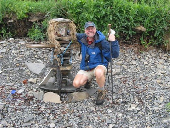
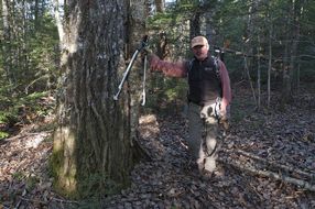
Don Hudson at Work on Trail

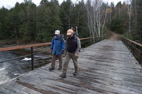
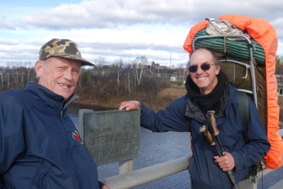
Earl Raymond and Don Hudson Crossing Wassataquoik Bridge
After a couple of aborted attempts to set up a fall work trip primarily due to weather we finally got a group together to attack the high water trail. The original plan was to work out of the Wassataquoik Lean- to but it became obvious that the distance people would have to walk to the work site and return, about 4 miles, would not be feasible. The alternative was to work from Lunksoos Camps and cross the East branch by canoe. This would get us within just over a mile walk the Wassataquoik Bridge and the beginning of the 1.8 mile HWT project. Earl contacted Sarah Spencer and Mark Leathers, and Sarah graciously set things up including permission to use Tom Chase’s canoe.

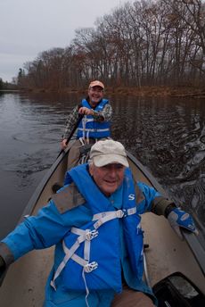
Earl Raymond and Don Hudson Crossing the East Branch
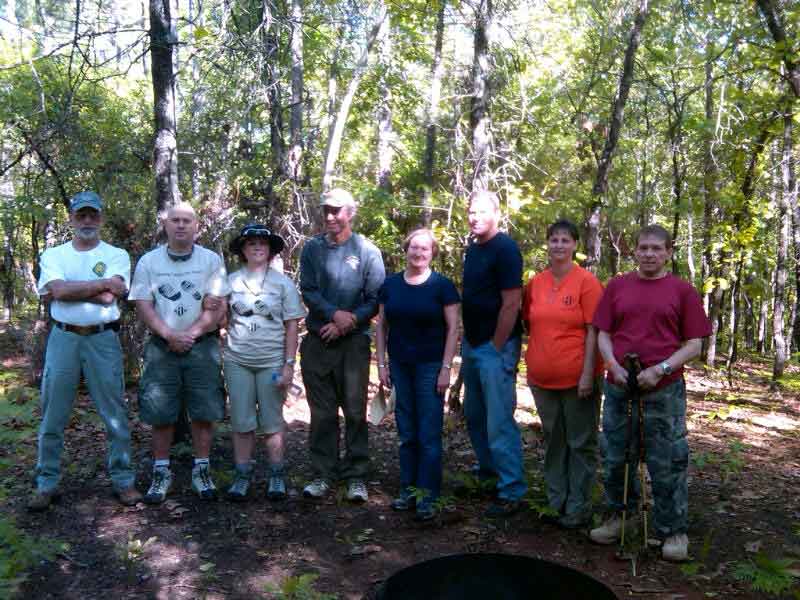
The final work crew included Earl Raymond, Walter Anderson, Bill Duffy, Don Hudson and Cliff Young. The first three left from Falmouth at 6:30 AM, picked up Don in Topsham, and continued on to Sherman Station where we proceeded an additional 10 miles on the Sherman Lumber Company Road. From here it was only 1.6 miles south on the Sebois Road to the camps. We set up camp, got the canoe from storage and headed across the East Branch to Sarah’s trail. We were at the worksite, Wassataquoik Bridge, at about 1 PM. We decided to work on the trail until about 3:30 PM, which would allow us to be back at the canoe at approximately 4:30 PM. It was a beautiful day and we got a lot done.

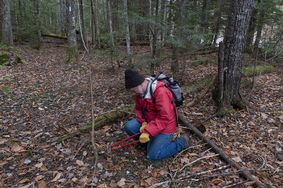
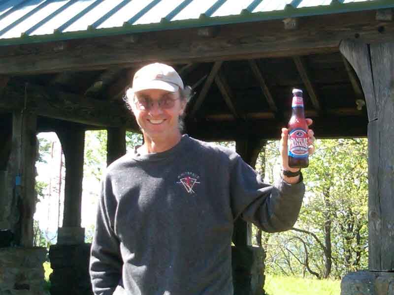
Cliff Young Working on Trail
Cliff Young had driven up and stayed at Lunksoos camp on Wednesday night. He left a note that he would be at the other end of the 1.8 mile trail working downstream along the Wassataquoik toward us. Cliff arrived back at the camps just as we were pulling in at the canoe landing.
Walter prepared his eagerly anticipated beans and dogs and told us unusually scary stories of his days working as the state geologist.
We woke up to a snow squall Friday morning, which quickly turned to a very beautiful day. Don and Bill crossed the East branch and proceeded to the trail. Cliff and Earl drove to the other end of the trail via Whetstone Bridge, a distance of approximately 8 miles, to the infamous monster washout. They put up two signs where the 1.8 mile trail leaves the Wassataquoik Tote Road and proceeded to clear the old road/trail toward where Bill and Don were clearing. They met about 10 AM and continued clearing with Don & Bill to the public lot line. Cliff and Earl returned to the Wassataquoik tote road brushing and flagging along the way.
Cliff & Earl walked up stream along the Wassataquoik Tote Road for about a mile to check the condition of the road. It is in very good condition and did not require any clearing.
The 1.8 mile section of the high water trail follows an old road and did not require any chain saw work. There is evidence of trimming probably done by fishermen who were using the trail to get to the upper Wassataquiok. The last ½ mile on the upstream end will need some trimming but it is not critical.
Chop Suey by Walter for dinner and early to bed.
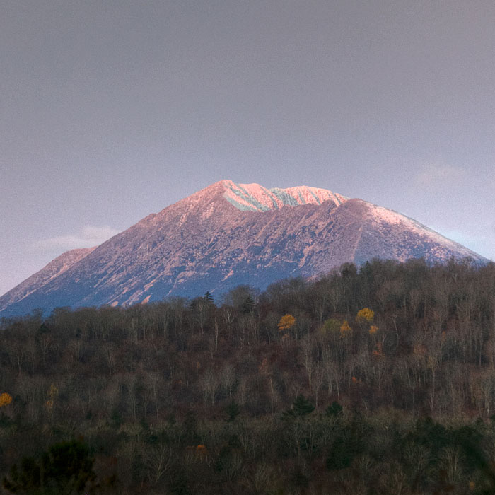
View of Katahdin
Saturday morning brought a beautiful sun rise view of Katahdin with snow, and Bill took a spectacular picture (included with this report). We broke camp and left via the Staceyville Road. Walt wanted to get a look at the Whetstone Bridge so we diverted the few miles to see it.

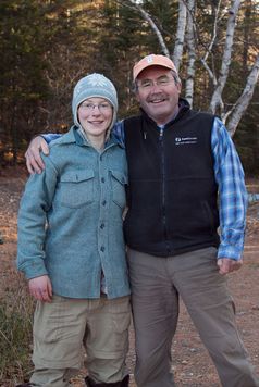
Don Hudson with niece Becca

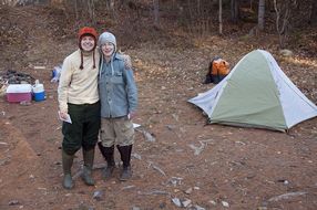
Lily & Becca at Whetstone Bridge Campground
Don had been telling us about his niece who was on an extended canoe trip and, although he did not know when, she would be coming down the East branch. As fate would have it, his niece, Becca, and her friend Lilly were camping at the Whetstone Bridge campground. We were all very impressed with these two young people and they were happy to see Uncle Don.
Successful trip thanks in large part to Sarah & Mark.
The High Water Alternate route is a great section of trail, which will eventually be incorporated into a loop trail system.
Report by Earl Raymond
Photos by Bill Duffy

Maine Chapter Attends ALDHA

The Appalachian Long Distance Hikers Association met a little closer to home this year. The annual Gathering of ALDHA was held at the Massachusetts College of Liberal Arts in North Adams over Columbus Day weekend — Oct 7-10. Our contingent from Maine was lead by Dick Anderson and Walter Anderson, accompanied for the first time by Don Hudson and Seth Levy. Steve Pinkham and Suzanne Goulet also joined the group for the largest representation from the chapter in 15 years of attendance at ALDHA Gatherings.

ALDHA attendees

Opening Session
The corner booth at the Hiker’s Fair was visited by nearly all of the 450 participants at the Gathering, most of whom were very interested to hear about the growth of the trail in Europe. Information about hiking in Atlantic Canada and Scotland disappeared from the table top as quickly as it could be placed there. Three cases of water donated by Poland Spring were also snapped up in a day and a half. The Maine Chapter also held a small raffle of several items to support ALDHA. Autographed copies of Eb Eberhart’s (Nimblewill Nomad’s) two books – Where Less the Path is Worn and Ten Million Steps – were included along with two copies of the AMC’s Guide to Winter Camping and Nopack’s original day pack.

IAT Booth

Andrew Skurka speaking with Seth Levy at IAT Booth
The Maine Chapter was also well represented amongst the presenters. Seth Levy and Steve Pinkham drew a crowd on Saturday morning to hear about the 30-mile section of trail east of Baxter. While Seth highlighted aspects of the route, Steve added information about the history of lumbering and sporting camps along the way. Don Hudson presented an update on activities in Europe and North Africa from June 2009 to the present, including the trips to Scotland, Ireland, Northern Ireland, Wales, Spain, Portugal and Morocco. The latest updates included the identification of the entire IAT route in Scotland and the addition of a new section in Wales. At the last meeting of the Scottish Chapter, in addition to electing officers, the group identified the route of the IAT across the country. Beginning in the south, the trail will run from Mull of Galloway near Stranmaer to Glasgow along the Firth o Clyde Rotary Trail, from Glasgow to Fort William along the world famous West Highland Way, and from the foot of Ben Nevis in Fort William to the tip of Cape Wrath along the Cape Wrath Trail. The Welsh Chapter has added the Pembrokeshire Coastal Path in the southwest to their IAT route. Walter Anderson presented a concise review of the geology that underpins the IAT to a very engaged audience. It is becoming clear that the history of the formation of the Appalachian mountains going back 100s of millions of years is one of the compelling stories of the IAT. It is also fair to state that the trail is stimulating increased interest and understanding in the forces that have shaped the planet. Dick Anderson concluded the slate of four Maine Chapter presentations with a travelogue of the highlights of hiking in Newfoundland. It was clear by the level of interest at this and other presentations that interest in long distance hiking in Atlantic Canada is growing.

Don Hudson – Extending IAT into Europe

Dick Anderson – IAT in US and Canada
A highlight of the weekend was a presentation by extreme adventurer Andrew Skurka. Nearby Williams College hosted the presentation in their large, modern theater, and the room was packed to hear Andrew and see pictures and video of his 4,700-mile trek by foot, ski, and pack raft around Alaska and the Yukon Territory in Canada. This remarkable journey was just the latest in Andrew’s young life, and the fourth major expedition since he walked and snowshoed across the United States and Canada eight years ago – including the stretch of the IAT from Cap Gaspé to Katahdin. This latest adventure will be chronicled in the March 2012 edition of National Geographic, and will include stunning photography and the details of joy, hardship and even some peril that marked the journey. Don’t miss it!

Andrew Skurka
Next year’s Gathering will move south, likely to Concord College in Athens, West Virginia. We look forward to a return of the group to North Adams in 2013, where the Maine Chapter will once again be strongly represented.
Don Hudson
Photos by Walter Anderson

Quimby Family Foundation Gives Awards

IAT founder, Dick Anderson, was honored on Friday, August 26th, with the Green Heart Award of the Quimby Family Foundation. The award was presented by iconic land conservationist and Burt’s Bees founder, Roxanne Quimby, at the grants award luncheon held each August by the foundation. Dick was received with warm and enthusiastic applause when Quimby walked to the microphone to announce the 2011 winner of QFF’s Green Heart Award.

Roxanne Quimby presenting to Dick Anderson
Quimby told the luncheon audience that the Green Heart Award is presented to someone who has not only accomplished great things in their working life, but someone for whom respect for nature and wild places is at the core of their being. Dick’s career spans over 50 years, beginning shortly after college at the University of Maine in 1955 to work as a fisheries biologist, notably as Maine’s first land-locked salmon specialist with the Maine Department of Inland Fisheries and Wildlife. When the old Portland Museum of Natural History merged with the original Audubon Society in Maine in 1969, Dick was chosen as the first modern executive director of the new Maine Audubon Society. Dick next served for 8 years as the Commissioner of the Department of Conservation during the tenure of Governor Joe Brennan. Leadership of the bold caribou reintroduction project followed. It was during a visit to the Chic Choc mountains of the Gaspé Peninsula for the Caribou project in 1989 that the idea of extending the historical Appalachian Trail from Maine to Quebec was born. The International Appalachian Trail was launched in 1994, keeping Dick very busy for the past 17 and a half years. Throughout his long career, Roxanne noted that "Dick’s energy, enthusiasm and dedication to the conservation of nature never waned."
Don Hudson, long-time Secretary of the IAT, is the only other person ever to receive the GREEN HEART AWARD. He received his award from Roxanne in August 2009 for a wide range of lifetime achievements including his service as President and Chief Executive Officer of the Chewonki Foundation, Maine Representative on the International Gulf of Maine Council and as an original proposer of the International Appalachian Trail with Dick and Gov. Joe Brennan.

Don Hudson and Dick Anderson with Green Hearts
Dozens of representatives of non-profit organizations in the arts, education and the environment were on hand to receive their grants, including two representatives from the Maine Chapter of the IAT, Don Hudson and Seth Levy. The Maine Chapter grant will help with the production of a special online trail guide as well as informational kiosks and long-range planning for maintenance of the 30-mile section of the IAT east of Baxter State Park.

Walter Anderson presents Quimby grant to Seth Levy, IAT Board member
Walter Anderson was also praised and honored at the Quimby Family Foundation luncheon. Walter was recognized for four years of service as a QFF Board Member, during which time he was a great champion for proposals aimed at increasing understanding of natural phenomena as well as those promoting science and science education. Walter is also an enthusiastic supporter of arts and music, and Roxanne Quimby noted that he had made great contributions to the Board’s deliberations, offering a keen sense of humor in addition to his careful and critical evaluation of proposals.

Water Anderson, QFF Board Member and IAT Board Member
Story By Don Hudson

The Maine Chapter Board of Directors New Positions

The Maine Chapter Board of Directors met at the Bear Brew Pub in Orono on Thursday, September 8th. Among the usual review of finances and progress of thru-hikers, the Board focused on plans for the Annual General Meeting of the Chapters to be held at the Gîte du Mont Albert on the Gaspé (September 16-19) and the Annual Meeting of the Appalachian Long Distance Hiker’s Association (ALDHA) to be held on Columbus Day weekend in North Adams, Massachusetts. Walter Anderson also presented initial plans for the Maine Chapter Annual Meeting (May 17-19, 2012) to be held at Shin Pond Village.
In addition to the usual review of activities, the Board also discussed up-coming trail work on the alternate high water route from the Wassataquoik lean-to east of Katahdin Lake to the bridge over Wassataquoik Stream just upstream from the confluence with the East Branch of the Penobscot (October 12-15). In the event that the stream is too high to ford, this route can be used by hikers to access the trail north to Deasey and Lunksoos Mountains.
The Board also discussed a proposal by Ralph Brill of Brill Galleries in North Adams, Massachusetts to produce a book of photographs about the International Appalachian Trail — the Pangaea Project. The book will be assembled by a team of photographers, and it will tell the story of the trail from its beginning in Maine, New Brunswick and Quebec to its transatlantic development in Greenland, Iceland, Europe and North Africa. The Board authorized Dick Anderson to sign a letter of support and cooperation for Ralph to help him secure financial backing for the project.
Of special note, the first order of business at the outset of the meeting was the presentation to out-going Treasurer, Bob LeMieux of special recognition for his work managing the finances of the Chapter so effectively over the past four years. When Bob tendered his resignation in August, Dick Anderson decided that it was time for him to step aside as President of the Chapter, a post he has held since April 1994. Dick offered to serve as the new Treasurer, and he proposed that Don Hudson be nominated as the Chapter’s new president. Finally, Seth Levy was nominated to fill Don’s role as Secretary of the Chapter. The Board took up the nominations following the recognition of Bob LeMieux, and the new slate of officers was elected unanimously.

Out-Going Treasurer – Bob LeMieux (photo by Bill Duffy)

Copy of Bob’s Award

Out-Going President, Dick Anderson and Incoming President, Don Hudson (photo by Bill Duffy)
Following the vote of the Board of Directors, Dick Anderson shared his thoughts about the status of the Maine Chapter and the Trail overall.
I am retiring as President of the Maine Chapter of the International Appalachian Trail after 15 years. I feel it is time for new, younger leadership to take on the challenges of being involved in continued international development and the solidification of the tremendous expansion of the trail that has occurred in the last 10 years. The Maine Chapter IAT has also made great improvements in the Maine section of the trail and the organizational structure exists to continue excellent maintenance and explore new, improved trail locations.
I really appreciate all the great support I have received from the many volunteers that have developed the Maine section of the IAT and the many Board members that have been so involved in the smooth functioning of the Maine Chapter over the last 15 years. In addition, I thank all the members who have given us moral and financial support. This project has truly been a wonderful example of what a committed group of people, working together, can accomplish and I have been really happy to have played a part in the
development of the IAT.
I wish my successor, Don Hudson, great success and remain committed to continued involvement in all aspects of the development of the International Appalachian Trail.
Don Hudson shared his thoughts as well as he accepted his new role.
When Dick Anderson asked me to help him establish the International Appalachian Trail in October, 1993, I jumped at the chance. Dick Davies and Chloe Chunn joined us, and on Earth Day (April 22) 1994, Joe Brennan announced the goal to link the highest mountains in Maine, New Brunswick and Quebec with a long distance trail. Many others in Maine and across the region soon joined the effort, and on Earth Day 2001 we celebrated the completion of the trail at Cap Gaspé in Parc Forillon, Quebec. None of us could have imagined that the trail would eventually make its way across the Atlantic, from Greenland and Iceland to Northern Europe and North Africa.
Dick Anderson has done a remarkable job for nearly 18 years to keep the Maine Chapter of the IAT moving forward, as well as to establish a strong working network of chapters in Canada and Europe. Following his lead, all of us in North America have negotiated trail easements, built lean-tos and chalets, secured access through new territory, and established strong working relationships with the Appalachian Trail Conservancy and the long distance hiking community. I look forward very much to working on these and many other projects in the coming years, and I am especially pleased that Dick will continue to work with us as the Treasurer of the Maine Chapter.
The jump across the Atlantic presents wonderful opportunities for linking ancient trails and byways with the vibrant hiking tradition in the United States and Canada. Our routes through the Appalachian Mountains are young by comparison with paths through the West Highland glens of Scotland, the Roman roads of the Villuercas in Spain, or the paths that link Berger villages in the High Atlas of Morocco. Nevertheless, we share common goals for bringing people together in appreciation of grand landscapes and open spaces.
On a cold winter evening in January 1994, Dick proposed a simple vision to our small planning group — Nature knows no boundaries! We embraced that vision in a heart beat, and it has served us well for nearly two decades. The International Appalachian Trail will find new routes, new friends, and new leaders in the coming years, and I look forward to carrying Dick’s vision into that bright future.

WASSATAQUOIK WORK TRIP PLANNED

A work trip is being planned for October 12–15. The trip will be to the Wassataquoik Campsite east-of-Baxter. The work will include clearing on the High-water Alternate trail route and continued clearing along the trail between the Wassataquoik Stream and the summit of Deasey Mountain. Participants will camp at the Campsite.
Those interested should contact Dave Rand, work trip coordinator–at drand@ainop.com to sign up or get more details.

Work Crew "Spruces-Up" Trail Section Between Baxter State Park and Deasy Mountain

Dave Rand, Earl Raymond, Don Hudson, Will Richard – Photo by Walter Anderson
The Maine IAT Wassataquoik work party spent a productive two days camped at the Wassataquoik Campsite on June 22nd and 23rd. The party was made up of Board members: Dick Anderson, Walter Anderson, Dave Rand, Earl Raymond, Will Richard and Don Hudson and IAT Maine Chapter member Roger Gilmore. As usual Walter did a great job~managing the campsite and organizing the food and drink, Dick brought a large amount of his surf-clam chowder(it actually had clams in it this time) and Don brought some of that new BAXTER beer–Pamola Extra Dry Pale Ale.
All the signs were checked and repaired, the fire ring was cleared to Maine Forest Service specs, trail cleaning, blowdown removal and the addition of many new "tags" was completed.

Roger Gilmore and Dick Anderson – Photo by Walter Anderson
The high-water, alternate trail route was also surveyed and the required trail work on that route was catalogued for completion this Fall.

Don Hudson – Photo by Will Richard
Due to the removal of the bridge where the trail crosses Katahdin Brook it was necessary to clear a well marked detour trail and ford,~downstream of the old bridge. That project was completed and is ready for hikers.
The down-side~of Spring trail work is an abundance of black flies~ and we were not disappointed–they were wicked abundant.~All-in-all everyone had a great time, got some necessary work done and had some great companionship in the woods.

Roger Gilmore & Earl Raymond – Photo by Walter Anderson

Earl Raymond and Dick Anderson – Photo by Walter Anderson

Dave Rand and Roger Gilmore – Photo by Walter Anderson

Dick Anderson, Earl Raymond, Don Hudson, Dave Rand – Photo by Will Richard

Dave Rand – Photo by Will Richard

Don Hudson – Photo by Will Richard

Don Hudson – Photo by Will Richard

Dick Anderson – Photo by Will Richard

Roger Gilmore – Photo by Will Richard

Seth Levy and Steve Pinkham’s Backpack Trip on the IAT

Steve Pinkham, Seth Levy, Dick Anderson – photo by Walter Anderson
Recently Seth Levy an IAT Maine Board member and author Steve Pinkham thru-hiked the southernmost 35 miles of the International Appalachian Trail Starting at Avalanche Field in Baxter State Park and ending at Matagamon Wilderness Campground. Their hike was a test of the map and Trail Guide and an inspection of the condition of the trail. Neither had been in the East-of-Baxter area before. The story of their hike by Steve follows:
Seth Levy and Steve Pinkham’s Backpack Trip on the IAT, June 13th to 16th, 2011
Monday, June 13th
Dick and Walt Anderson arrived at Seth’s house in Brunswick and we headed north, arriving at the Baxter State Park gatehouse, where Zack checked us in, once he found out how to accommodate northbound hikers.

Baxter Park Entrance – Photo by Walter Anderson
We arrived at Avalanche Field about 11:30, said goodbye to Dick and Walt, and headed west on the Katahdin Lake Trail, trekking three miles to Katahdin Lake Camps. Nobody was there, so we had a lunch and headed north, coming to the outlet of Katahdin Brook. Realizing we were not on the IAT, we retraced our steps to the camps and located the Katahdin Lake Trail, which headed due south from the dining hall. This trail we followed to the park boundary, where we left our Baxter Registration card in a box and located the IAT sign.

Katahdin Lake Trail – Photo by Walter Anderson
We turned north, walking five miles on new and old tote roads, having to ford over Katahdin Brook due to the recent rains, and arrived at Wassataquoik Shelter, after a ten mile hike, where we had supper and camped in the lean-to.
Tuesday, June14th
After coffee and breakfast we broke camp and hiked along the Wassataquoik to the Old Ford, where we used poles and sticks to balance in the quickly moving water, which was up to our waists. On the opposite bank we paralleled the river for half a mile, then lost the trail, but eventually located it, headed on and forded over the inlet.
Here we left the stream and headed northeast on a woods trail, passing Earle’s Erratic and came to the new detour, which we took and arrived at the Warden’s Cabin about lunchtime. Here we encountered the steepest mile of the entire trip, up to the summit of Deasy Mountain. The view of Katahdin and The Traveller range was spectacular as the lingering low clouds had finally burned off. Northeast was the cone-shaped Sugarloaf and Chase Mountain. The fire-warden cab was intact, just needing to be repainted; a large hawk flew by while we admired the view.
Another mile brought us to the open summit of Lunksoos Mountain, where the views were equally spectacular, and a mile descent brought us to a watering hole and the Lunksoos Shelter, with its tree-framed view of Katahdin. The bugs were out with the sun, so we moved on, hiking four or so miles to the East Branch. Here the bugs came out in hordes, so we hurried along the old tote road, crossed the East Branch on the snow-mobile bridge and arrived at Bowlin’s Camps about suppertime.
We were welcomed by Dora with a nice refreshing glass of lemonade and rested while they prepared our beds in the bunkhouse. We then enjoyed welcome showers and after a delicious supper, we talked with the caretakers awhile, getting to bed early as we had walked fifteen miles that day.
Wednesday, June 15th
In the morning we enjoyed a nice breakfast in the dining hall, purchased two well-needed bug nets, paid our bill and said goodbye, heading north on the IAT. The next mile took us over a ridge, the trail being very wet and boggy due to the June rains. The path then lead down to the East Branch and we followed it, passing three spectacular waterfalls – Grand Pitch, Pond Pitch and Haskell Rock Pitch, which were swollen by the rains.
After a long rest at the last waterfall, we walked north and somehow got onto the Messer Pond Road, missing a long section of the IAT. This took us past a beaver flowage to a newly built road and gate, so we continued, keeping the Traveller and Billfish Mountain on our left and soon rejoined the IAT. It was several miles to the Shin Pond Road and Matagamon Wilderness Camps and Store, where we enjoyed much deserved cold drinks and ice cream.
We set up camp along the East Branch next to a group of canoeists who serenaded us to sleep with some wonderful harmonic songs.
Thursday, June 16th
Got coffee and breakfast in the store, talked with the owners while, packed up, showered and soon Dick and Geraldine arrived and we headed home with memories of a wonderful trek on the International Trail in Maine.
Steve Pinkham & Seth Levy

June 2011 Trail Work Trip Report

FRONT: Jude Eldridge, Bill Duffy, Earl Raymond, Walter Anderson, Dave Rand
BACK: Jas Smith, Herb Hartmann
Bowlin Camps Based Work Trip: Bowlin Camps, on the East Branch of the Penobscot River, was the base for a three-day, Maine Chapter, IAT/SIA work trip June 3, 4, 5, 2011.
Bill Duffy, Jude Eldridge, and Bill’s dog, Trip, checked the trail while hiking to the summit of Deasey, completed and marked the Warden Camp cut-off trail and spent two nights in the cab.

Deasey Summit
Dave Rand, Earl Raymond, and Jas Smith inspected and cleaned the Lunksoos campsite area, and trimmed brush on the trail. Dave’s scythe work was particularly impressive. Jas checked the trail to the summit of Lunksoos Mt.
The ATV ford at Little Hathorn Brook was improved (the dilapidated bridge has been completely removed); Grand Pith campsite cleaned, the fire ring grubbed; and the trail inspected as far as the junction with the Little Messer Pond Road.
Walter Anderson and Earl installed Don Hudson’s routed signs at Thoreau’s Checkerberry Tea site and Stair Falls and inspected the trail by vehicle from the Matagamon Road south as far as they could drive.
Walter provided food and cooked superbly. A wonderful turkey dinner was provided by Bowlin Camps Sunday evening. The entire crew departed Monday morning satisfied they had accomplished more than they had set out to do.
The Artist and the Mapmaker
by Jude Eldridge, IAT Poet Laureate
The sun was shining on the ridge,
Shining with all his might:
He did his very best to make
The trees all green and bright –
And this was odd, because it was
The middle of the night.
The air was hot as hot could be,
The culverts pulled – some dry.
You could not see the trail because
The hobblebush was high.
No markers flying over head –
There were no tags to spy.
The Artist and the Mapmaker
Were hiking IAT
They wept like anything to see
Such quantities of tree.
‘If this were only cleared away,’
They said, ’How grand t’would be!’
‘If seven guys with seven scythes
Slashed for half a year,
Do you suppose,’ the Artist said,
‘That they could get it clear?’
‘I doubt it,’ said the Mapmaker,
And shed a bitter tear.
‘O Blackflies, come and walk with us!’
The Artist did beseech,
‘A pleasant walk – a pleasant talk,
Among the ash and beech:
We cannot do with more than four
To give a hand to each.’
Four thousand Blackflies hurried up,
All eager for the treat:
Their coats were brushed, their faces washed,
Their teeth were clean and neat –
And this was odd, because, you know,
They hadn’t any teeth!
Four thousand Blackflies followed them,
And yet another four,
And thick and fast they came at last,
And more, and more, and more –
All flying through the mottled woods,
And scrambling to the fore.
The Artist and the Mapmaker
Walked on a mile or so,
And then they rested on a rock
Conveniently low:
And all the little Blackflies stopped
And waited in a row.
‘The time has come,’ the Artist said,
‘To talk of many things;
Of Earl – and Herb – Dave’s ATV –
Of cabbages – and kings –
And why the snoring never stops –
And what is it Walter sings?’
‘But wait a bit,’ the Blackflies cried,
‘Before we have our chat;
For some of us are out of breath,
And all of us are fat!’
‘No hurry!’ said the Mapmaker,
They thanked him much for that.
‘I weep for you,’ the Artist said:
‘I deeply sympathize.’
With sobs and tears she aimed her hand
At those of largest size,
Holding fly-doped handkerchief
Before her streaming eyes.
‘O Blackflies,’ said the Mapmaker,
‘You’ve had a pleasant run!
Shall we be trotting home again?’
But answer came there none –
And this was scarcely odd, because
They’d swatted every one.

THOREAU’S CHECKERBERRY- TEA CAMPSITE & STAIR FALLS

INTERNATIONAL APPALACHIAN TRAIL
THOREAU’S CHECKERBERRY- TEA CAMPSITE & STAIR FALLS
by Earl Raymond, Maine Chapter IAT/SIA

The East Branch of Maine’s Penobscot River is famous for canoeing and fishing. Many hundreds of tourists and fishermen have made the trip from Matagamon Dam down to the Penobscot’s West Branch in East Millinocket. The river is little changed since Thoreau made his journey, especially from Grand Lake to Whetstone Bridge.
Two, routed, informational signs, both in T5-R8 WELS were installed on June 4, 2011, along the IAT. The Thoreau sign at the top of a steep bank on the East Branch of the Penobscot and the Stair Falls sign about one mile north of Haskell Rock along the trail.
Thoreau’s 1857 trip is well known and much has been written about it and his Indian guide, Polis.
The location of any of Thoreau’s campsites is of interest to many people. In this case, Thoreau describes a location that can only occur for a very short distance along the East Branch. In 2005 I decided to see if it was possible to locate this campsite by putting in at Matagamon Bridge and kayaking down the river the “some 5 miles“described by Thoreau. As it turned out, it is closer to three miles to the campsite’s location.
Thoreau wrote three pages about his stop here including Polis having found ”steel traps under a log, thirty or forty “, and lots of notes on flora.
Thoreau campsite 30 July 1857: Allegash & East Branch, chapter 8, pages 29-31
The description by Thoreau of his East Branch campsite on 30 July 1857, 154 years ago, is very detailed. “Having carried over the dam….. and glided down the stream in smooth but swift water for several miles…. we stopped at the first favorable shore, where there was a narrow gravelly beach on the western side, some five miles below the outlet of the lake. It was an interesting spot, where the river began to make a great bend to the east, and the last of the peculiar moose-faced Nerlumskeechticook mountains not far southwest of Grand Lake rose dark in the northwest a short distance behind …. but we could not see this without coming out upon the shore. “
There is only one short area on the East Branch where this condition exists; it is at the beginning of what is now shown on maps as the “Oxbow”. The mountains can easily be seen from the river south of this area, although going downstream it requires turning around and facing up the river to confirm this.
These mountains are Billfish and Horse. Billfish is closer and very prominent; Horse is lower but shows a steeper face from both the land and the river. Billfish can be seen for a long way when coming up the river, around the bend of the Oxbow, because the view is looking up the channel in a northwesterly direction. Horse appears lower and to the east because it is farther away.
There is a stream coming in from the west, just up the river, that limits the area of the campsite because of the “bank four or five feet high”.
The woods (interminable forest) that Thoreau mentions are not here now. There was a camp in the vicinity that has been removed, and there is a” bank four or five feet high.” There is also a gravel road along the river at this point. Billfish can be seen from the location of the sign.
Thoreau called this Checkerberry-tea Camp because the Indian, Polis, made some pretty good tea from the Checkerberry (Gaultheria procumbens) by dropping a little bunch of it tied up with cedar bark into the kettle.
The next day Thoreau continued down the river and writes of smooth but swift water, which it is in the Oxbow, but never mentions Stair Falls that are less than a mile downstream and very prominent. The falls would not have required a portage in midsummer. After Stair Falls are: Haskell Rock Pitch, Pond Pitch, Grand Pitch, Hulling Machine Falls, and Bowlin Falls, before Thoreau’s next campsite. “We had heard of a Grand Fall on this stream, and thought that each fall we came to must be it, but after christening several in succession we gave up the search. There were more Grand or Petty Falls than I can remember.”
Thoreau’s next campsite (July 31.) was below the mouth of Wassataquoik Stream. “We had passed the Wassataquoik without perceiving it.”—–“camped about a mile above Hunt’s, which is on the east bank—“
STAIR FALLS

The Stair Falls sign is located on the IAT about one mile north of Haskell Rock. There is a good road/path from the sign leading one mile to the falls.
The first written record that we have of the falls is in the 1793 survey Field Book of Jonathan Maynard. Maynard was engaged by Massachusetts (Land Committee) along with Park Holland to survey the Penobscot River and lay out a line 6 miles east and parallel to the river. This six mile strip was to be reserved for the Indians.
JULY 30, 1793
“Left home and go to Boston, on my way to the Eastward on a Survey with Capt Park Holland where we receive our instructions from the Land Committee and Provisions for the Voyage and continue in town until the 4th of August “
Maynard and Holland sailed for the Penobscot River, proceeded up the river in a small schooner, and on the 8th day of August arrived at a place called Canduskeeg or Bangor. At the head of tide they made Quarters with Col J. Eddy, engaged our men for the survey, and were sworn by Justice Eddy. On the 13th they stopped at Indian Island in Old Town but found no Indians there.
It takes Maynard & Holland until the 16th of August to start the survey near Old Lemmon Stream, just north of Old Town.
On the 30th of August, Maynard came to the “Great Crotch of ye river” and proceeded up the East Branch.
Sept 01, 1793 “At 11 o’clock Capt Holland came up with his party, and we find that this way will not do. (They had been leap frogging). They decided: “Capt Holland to run the line over to Quoddy and then as far north as he can and for me (Maynard) continue up river with what provisions we have.”
Maynard continued up river with his survey crew and on Wednesday 11th Sept 1793 made the following entry which would be difficult to say better.
“we mark a large pine 48 mile at ye foot of ye handsomest falls I ever saw – they resemble mill dams and run as straight across the river as a line can be drawn & are 8 or 10 in Number as regular as a stair case”
Maynard continues on “and come to the great Lake or Pond being 53 miles and 178 rods from Mattawaumkeeg ….and see an Otter on our arrival at the Lake and call it Otter Lake.”
There was no dam at this time; there were three or four small ponds. Later, when the dam was built, there was and remains today only one lake, Grand Lake Matagamon.
On his return to Massachusetts, Manard compiled a very professional, large-scale map that can be found in the Massachusetts Archives in Boston.