Why is there so much road walking on the Maine section of the IAT?
This is an incredibly fair question with an equally fair answer: throughout its existence, the Maine chapter of the IAT has relied on the generosity of landowners to secure the route for the trail. In the early years of the project, the owners of Mars Hill Mountain were the first to sign an agreement that allowed the IAT to cross their land. Permission to use the 20’-wide international border swath between Mars Hill and Fort Fairfield followed quickly. A $5,000 grant allowed for the purchase of materials to build the first lean-to on Mars Hill. The materials needed for the lean-to near Fort Fairfield were donated, as were the next 7 lean-tos built for the trail. In all cases, volunteers contributed the labor to create the campsites and improve the trail. In contrast, the Quebec chapter of the IAT was given hundreds of thousands of dollars to build the infrastructure needed to support the trail located largely on publicly owned ‘Crown’ land. The route in Quebec was secured and all campsites were built by June 2001 because of this significant public investment. Over the past 30 years, and without significant public financing, the Maine chapter has worked hard to move the trail off public roadways. What follows is a brief history of the major land acquisitions that transformed the route of the IAT in the land east of Baxter State Park.
The original goal of the IAT was to connect the highest points in Maine, New Brunswick, and Quebec. This meant, ideally, starting at the summit of Mount Katahdin, which remains within the boundaries of Baxter State Park (BSP). However, issues around park capacity and limited infrastructure were cited as reasons to prevent the IAT from marking permanent trails within the park. In contrast, Forillon National Park in Quebec worked with the IAT to establish and mark existing trails. This kind of public support was not offered to the IAT in Maine until the land east of Baxter was donated to the United States to create Katahdin Woods and Waters National Monument.
In the early years of the IAT in Maine Baxter State Park Director Buzz Caverly and IAT Founder Dick Anderson agreed that IAT hikers could make their way on park trails so long as they had campsite reservations for their time in the park. Thru-hikers could reserve access to shelters to utilize around 47 miles of trails through the park. The route would then pick up on Grand Lake Road at the northern boundary before connecting to Route 159. This route is shown in green on Map 1. For those who were unable to reserve lean-tos, the IAT led from the southern boundary of the park, connecting with the AT at Abol Bridge. This route––a road walk––followed the Golden Road and Routes 157 and 11, shown in pink on Map 1.
This map shows the route through Baxter State Park, in green, that could be used with campground reservations and the route, in pink, which avoided the park and utilized public roadways. The blue outline signifies the boundaries of BSP.
In addition to negotiations with Baxter State Park, the IAT also met with the succession of landowners, including Great Northern Paper Company and JD Irving, in the effort to shift the trail from the side of the road into the woods east of the park. These conversations and negotiations stalled or ended quickly in large part because the landowners were wary of working closely with the IAT due to difficulties they experienced when the AT became a National Scenic Trail in the late 1960s. One such negotiation for access to land east of Baxter State Park ended with laughter on the company’s part because of how little money the IAT offered for a trail easement.
This situation would change once Elliotsville Plantation, Inc. (EPI) entered the picture in 2003. Even as the relationship with Baxter State Park and the IAT improved, the IAT was still unable to establish permanent trails within the park. Fortunately, the land east of the park, though heavily cut over, was the perfect place for establishing a permanent trail. Roxanne Quimby, founder of Burt’s Bees and EPI, began her acquisition of land east of Baxter by purchasing T5R8 township and a portion of T3R8, the latter including the summit of Deasey Mountain, outlined in red on Map 2. She was very open to collaborating with the IAT from the beginning of her ownership. By 2007, the IAT had signed Memorandums of Understanding with EPI the trail and campsites. The IAT was then able to establish a permanent trail, starting at a ford of the Wassataquoik Stream and ending at the summit of Deasey. As EPI purchased more land in the area, which included swapping property with a landowner, the IAT was able to construct the route we have today by 2008, shown in purple on Map 2. Further collaboration with the Quimby Family Foundation resulted in grants to fund work trips, trail building, and trail guides. Trail development in Maine has been funded largely by individuals, private corporations and foundations, without the provincial and federal support provided the Quebec and New Brunswick chapters.
This map also shows the route through BSP (shown in green), the alternate route (shown in pink), and the current route of the IAT (shown in purple). The red box indicates the general area in which Roxanne Quimby purchased land in 2003 at the beginning of her negotiations with land owners east of BSP. The difference between the pink and purple routes helps to illustrate the impact the land negotiations with EPI had on the quality of the trail.
Sophie Leigh, a student at McGill University in Montreal, wrapped up her Maine IAT internship in late July. The internship is open to Maine and other United States students at McGill by a generous Maine alumnus of the university, John Wasilewski. Sophie spent hours pouring through the Maine IAT archives at the Maine Historical Society in Portland to understand how the trail came to be, and especially how the route evolved over the years. Sophie also spent time helping to clear and maintain the section of trail from Wassataquoik Stream to the summit of Deasey, and that particular experience likely inspired this blog post.
Bill Duffy, Sophie Leigh (our history intern this summer), Don Hudson, Julia Daly, and Jas Smith all met up at the Lunksoos Lodge in the late afternoon/evening. There wasn’t a shared meal that night, so dinners ranged from meals people brought to snack bars and peanuts. The mantles were causing problems, but solar lights turned on at 9:30 pm and didn’t shut off until 2 am, which was a problem for people sleeping. We ended up using headlamps and unplugging the solar lights as the trip went on. Sophie set up shop in the lodge on a mattress in the back room, Don slept on the porch, Julia and Bill both slept in their cars, and Jas slept in the Deasey cabin all by himself.
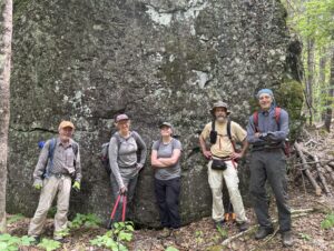
Don, Julia, Sophie, Bill, and Jas in front of Earl’s Erratic on the first workday
Friday, June 6, 2025
The day started off bright and early with granola and yogurt for breakfast, the preparation of lunches, and an hour-long drive down to the trailhead where the IAT fords the Wassataquoik Stream. Smoke from the recent wildfires in Manitoba was visible in the sky, obscuring any views of Katahdin, though it wasn’t too noticeable at ground level. There was a bit of sun throughout the day.
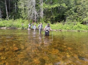
We met up with Amy and Dylan from the National Park Service, signed the appropriate paperwork, grabbed gear, and hit the trail. Dylan, an NPS archaeologist, was tasked with collecting data on the area surrounding the trail in hopes of identifying potential archeological sites, as well as documenting severe blow downs and new tags that were added to the trail. Amy was responsible for making sure we didn’t do anything we weren’t supposed to do. We successfully forded the stream and headed north up the trail toward Deasey Mountain.
Don, Dylan, Jas, Amy, Julia, and Sophie fording the Wassataquoik, which was thigh deep for some of us
The trail was in relatively good condition, with few major blow downs that we couldn’t clear with loppers, hand saws, and determination. Several new blazes were put up, and a handful of existing blazes were re-affixed or replaced. In some particularly dense areas, or areas where the trail had been recently re-routed, tags were added to clarify the route. The black flies were relentless, but we pushed on and made it all the way up to the Nose of Deasey for lunch. Sophie, Bill, Julia, and Jas hiked onward the little ways up to the Fire Warden’s Cabin, which remains in poor condition. Around 2 o’clock, everyone began the hike back down the trail toward the Wassataquoik.
After an 11-mile day on the IAT, we headed back to Lunksoos Lodge where we met up with Nancy Hathaway, who had just returned from California after a grueling 20-hour travel day (thank you for your dedication, Nancy!). Sophie went for a swim, and we all enjoyed spaghetti with a choice of pesto or marinara sauce with beef and Italian sausage (or both) to close out a hard but fulfilling day. Nancy camped out on the couch in the lodge.
Saturday, June 7, 2025
The day began again with granola and yogurt, the preparation of lunches, and the hour-long drive down to the trailhead. Nancy decided not to join us on our trail work excursion and instead hung back at the lodge and assigned herself dinner duty. Amy and Dylan also did not join us for this second day, as was planned. Though there was some rain expected in the forecast, everyone stayed mostly dry.
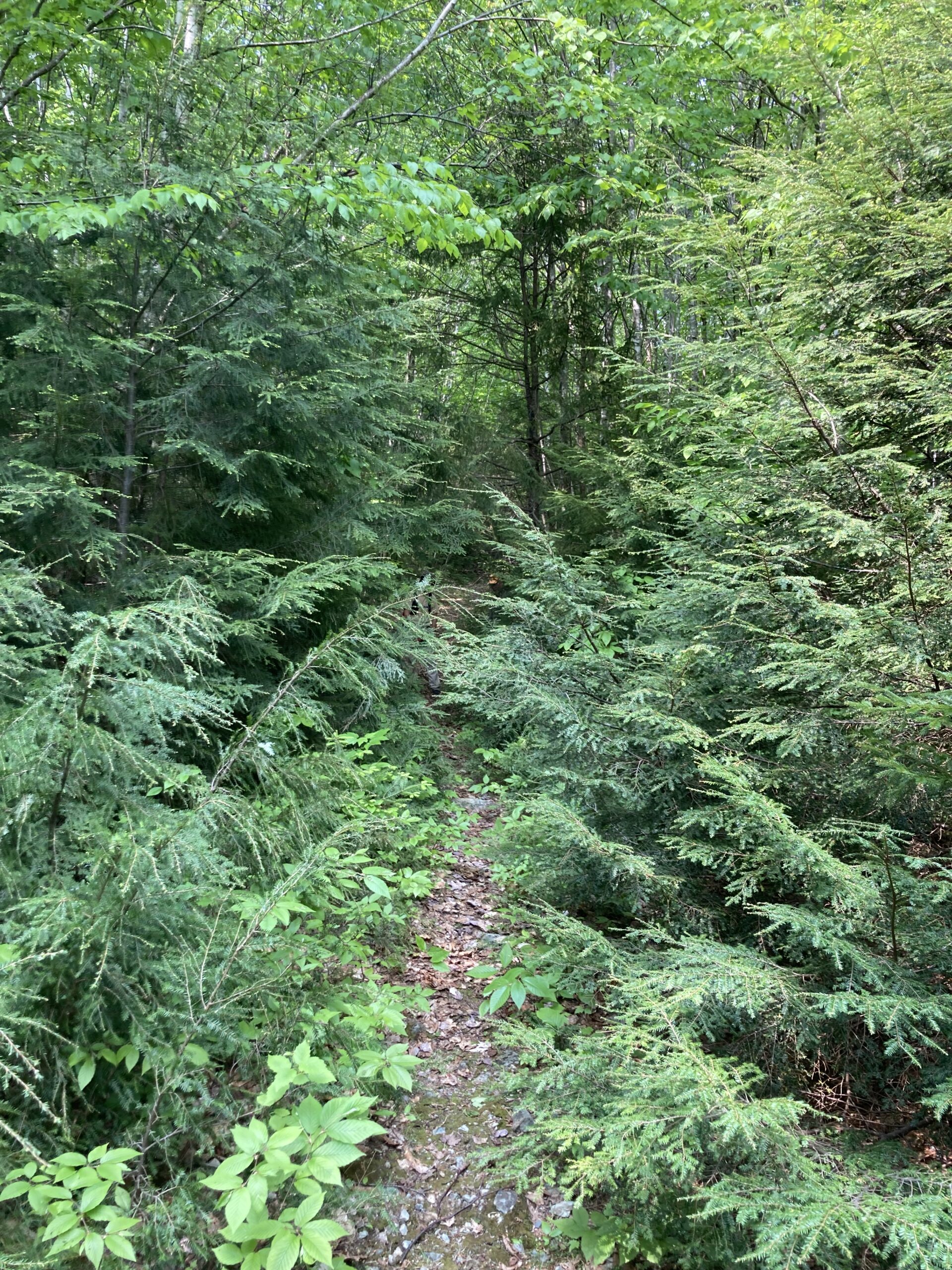
Before Trail Work Lunksoos (on the way to Deasy from Wassataquiok)
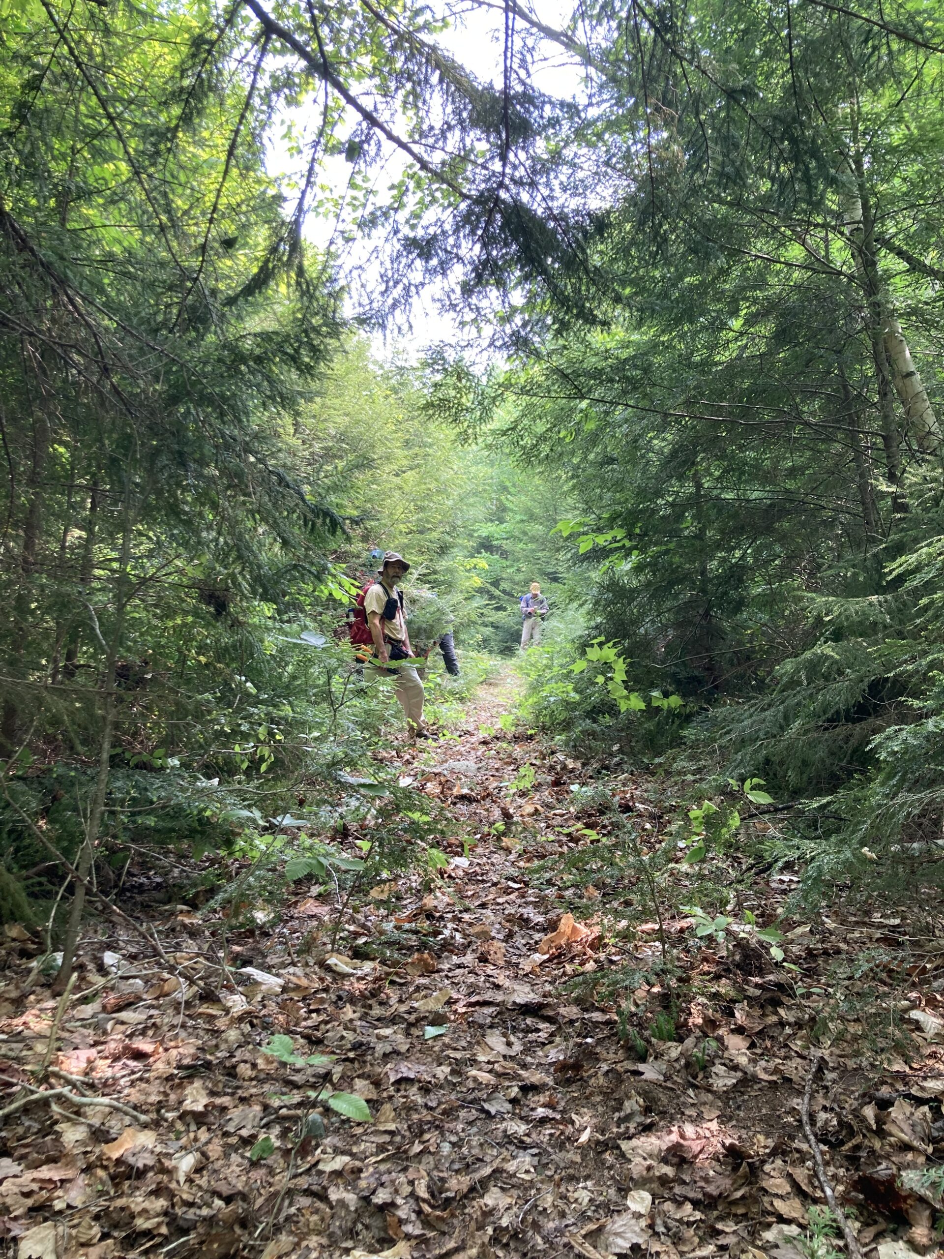
After Trail Work
We forded the stream and hiked directly to the Fire Warden’s Cabin, as little work needed to be done between the stream and the cabin thanks to the efforts of the day before. Any remaining work was planned for the return trip, as the goal was to potentially reach the summit of Lunksoos. After hiking the steep section up to the summit of Deasey, we had lunch while being attacked by black flies which were somehow worse than the day before. The Lookout Tower was in excellent condition, and Bill gave a quick lesson on how the wardens would have used their maps to triangulate where fires were. We decided not to continue further and instead headed back down towards the Wassataquoik, doing the little work that was needed as we made our way back.
Jas, Sophie, Bill, and Julia learning about how the map would have been used to locate fires (thank you, Bill, for the lesson!)]
Jas Smith, Sophie, Bill Duffy, Julia Daly
Everyone returned to the lodge by around 5:30 to find a beautifully set table with snacks and sides for the fajitas, which Nancy quickly got to heating up. It was delicious and well-deserved after a 13-mile day on the IAT.
The dinner table we returned to after a long day. Again, thank you, Nancy!]
Sunday, June 8, 2025
Breakfast was a bit fancier on the last day, with egg and sausage sandwiches for those that wanted them. Everyone helped with cleaning up the lodge and packing up cars, then headed out on their own time. Thank you to everyone who came for making this trip so successful. Also, shout out to Sophie for lowering the average age by 10 years!


![Jas, Sophie, Bill, and Julia learning about how the map would have been used to locate fires (thank you, Bill, for the lesson!)]](https://www.maineiat.org/wp-content/uploads/2025/06/Photo-6-scaled.jpg)
![Jas, Sophie, Bill, and Julia learning about how the map would have been used to locate fires (thank you, Bill, for the lesson!)]](https://www.maineiat.org/wp-content/uploads/2025/06/Photo-5-1-scaled.jpg)
![The dinner table we returned to after a long day. Again, thank you, Nancy!]](https://www.maineiat.org/wp-content/uploads/elementor/thumbs/Photo-7-scaled-r7jklrevjwmdd1txwidaf2q62jdkzk7jiytzng97f4.jpg "The dinner table we returned to after a long day. Again, thank you, Nancy!]")