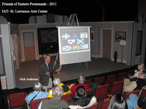
More than 60 people took a virtual hike along the International Appalachian Trail on Sunday, Feb. 13, 2011 at the St. Lawrence Arts Center.
“The International Appalachian Trail: Maine to Morocco,” sponsored by Friends of the Eastern Promenade (www.friendsofeasternpromenade.org) and Portland Trails (www.trails.org), explored the geology, geography, history and breathtaking scenery along the trail. Richard Anderson and Don Hudson, two of the people behind the International Appalachian Trail, along with Walter Anderson, Chief Geologist of the IAT Council, led the program.
The history and development of the trail was detailed in stunning pictures of the mountainous landscape between Maine and Morocco. The presentation explained how plate tectonics affected the breakup of the original mountains.
The International Appalachian Trail was proposed on Earth Day 1994 by Gov. Joe Brennan, Dick Anderson and Don Hudson. The three envisioned a hiking trail extending northward from Mount Katahdin – the northern end of the famous Appalachian Trail – along the Appalachian Mountains through Maine and the Canadian provinces of New Brunswick and Quebec. The idea received strong support in Maine and Canada, and after numerous meetings between citizens along the proposed route, a trail was developed from Mount Katahdin to Mont Carleton in New Brunswick and ending at the summit of Mont Jacques Cartier in Quebec.
Buoyed by worldwide publicity, supporters hope to extend the trail throughout the original Appalachian Mountains that existed 300 million years ago during the age of the super-continent Pangaea. Plans are under way to continue the trail southward to France, Spain and Portugal and ultimately to the geological end of the original Appalachians in the AntiAtlas Mountains in Morocco. Beyond the United States and Canada, IAT chapters now exist in Greenland, Iceland, Norway, Sweden, Denmark, Netherlands, Ireland, Wales, Scotland, and England.